Juedische Geschichte App
Web-App »Places of Jewish history«
Webtool of location-related information on Jewish history
Steinheim-Institut
Developer and contact person: Harald Lordick
Version: February 2020
Description
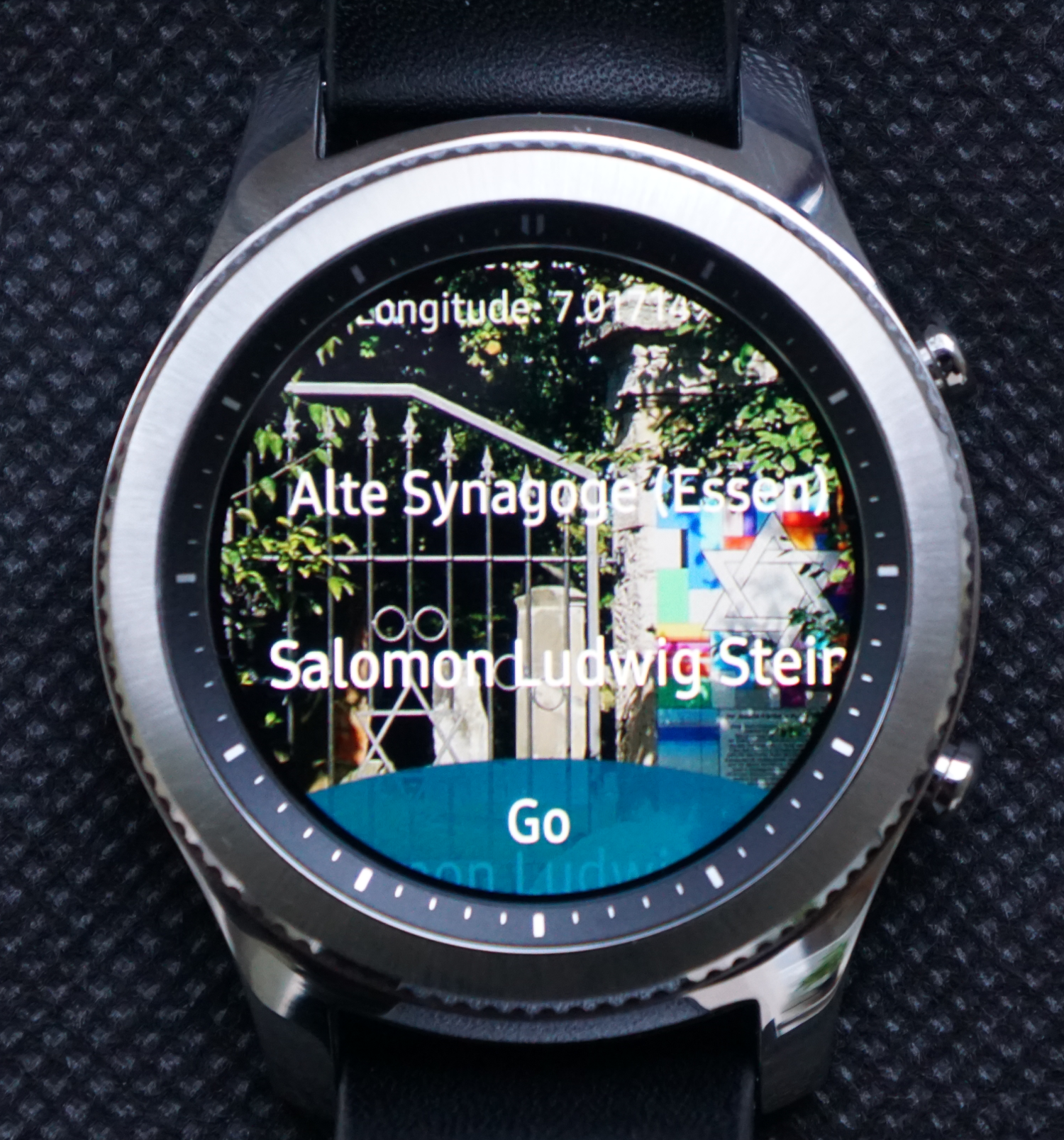
The web-based app, which was published in 2013, is constantly being updated and expanded in terms of function and content, exploiting in particular numerous articles of Wikipedia, which contain site-related information on, among other things, Jewish and cultural history, as well as German history (Jewish persecution, Antisemitism, Nazi-era, Book Burning, November Pogroms, ... ). It also groups those articles according to the selected geographic location. In this way, users are given a quick first overview and local (scientific) historical information: this can be a former synagogue, a still preserved Jewish cemetery, the place of a historical event and so on. The result of the request contains a simple map visualization and an interface for mobile navigation. The web app is designed for smartphones and mobile devices, but works in the usual web browsers as well and aims for its own English user interface and international users.
Positioning
- current position of the smartphone
- local dialing using the DARIAH-DE-Geoservice
- manually entered geo coordinates
Launch the App directly
Click here to go to the tool.

Research questions
The application is developed in the context of a professional interest. At a given geographic location, it allows to address questions such as:
- What remains of Jewish cultural heritage are nearby?
- Where exactly are the mentioned / known places?
- What is actually generally known about the specific (German-) Jewish local history?
- What conclusions can be drawn from the location of places and events (also in relation to each other)?
On the other hand, methodological questions are also discussed:
- How should a data format of human sciences documents suitable for cooperation with this application be designed?
- What is required to develop the application for more sophisticated analysis and / or collaboration with appropriate tools?
- How would a generic version suitable for other disciplines in science be derived?
Data set
Standard data and interfaces
The mobile web app obtains its data via defined (standard) web interfaces. Without these APIs it would not be practicable. Moreover, access to standard data is also indispensable. Only the standard data-based geoservice, as is available here in the infrastructure, allows the user to navigate easily and efficiently to relevant places and to display the relevant technical content dynamically.
- Geoservice DARIAH-DE-TGN API (XML-REST-Service)
- VM DARIAH-DE
- Wikidata (API)
- STI Linked Data / GND / BEACON
- experimental interface for the Telegram messenger
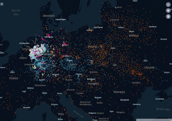
Data (February 2020)
- Wikipedia article on German-Jewish history
- Concentration Camps / Ghettos in Nazi-occupied Europe (European Holocaust Research Infrastructure EHRI / Wikidata)
- Editions from »epidat« (Steinheim-Institut) (RSS-Feed)
- NS-book-burnings 1933 (HL)
- Citizen Science
- Open Data (Open.NRW)
- »Stolpersteine« (tripping stones) (georeferenced entries of Wikipedia)
- georeferenced bibliographies (German-Jewish history NRW, Poznan Jewish history)
The continuous expansion of the data base is part of the development strategy.
Programming
XSLT.
You can find more about the app on the blog »German-Jewish history digital« ... as well as on Twitter: Jewish Places App
Supporter
Independent research and development
Steinheim-Institute
DARIAH-DE (Services and Infrastructure)