Geobrowser
Geo-Browser
Lower Saxony Göttingen State and University Library (SUB)
Responsible DARIAH-DE developer: Stefan E. Funk, Ubbo Veentjer
Contact Person: Stefan E. Funk
To the tool and documentation
DARIAH-DE Geo-Browser | Documentation and FAQ
Description
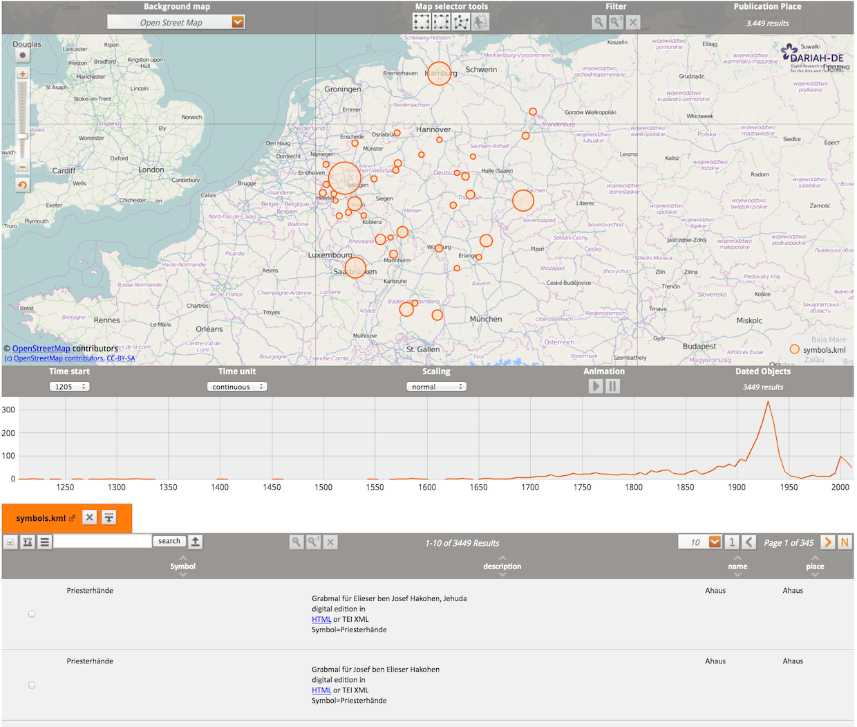
The DARIAH-DE Geo-Browser allows a comparative visualization of several requests and facilitates the representation of data and their visualization in a correlation of geographic spatial relations at corresponding points of time and sequences. Thus, researchers can analyze space-time relations of data and collections of source material and simultaneously establish correlations between them. This sample dataset for the Geo-Browser shows publishing dates and locations of works by Friedrich Schiller and Johann Wolfgang von Goethe plotted against each other.
The DARIAH-DE Geo-Browser is refined on the basis of europeana4D and GeoTemCo and is available to researchers of the humanities and cultural sciences for the analysis of space-time relations of data. The SUB Göttingen and other partner organizations of DARIAH-DE work together closely in development and cooperate in a working group founded in March 2013. The group e.g. holds and works together with representatives of the MPI for History of Science in Berlin, the Fraunhofer IAIS in Sankt Augustin and the University of Leipzig, in particular Stefan Jänicke, to discuss and coordinate the developmental process. The Atlas der Innovationen des Exzellenzclusters 264 - Topoi, whose Geo-Browser Module is also publicly accessible, ensures a close coordination and developmental cooperation.
Research Questions
The research questions to be answered with the Geo-Browser are numerous. The Geo-Browser is an interdisciplinary tool or service that can analyze space-time relations of various perspectives. E.g. questions about archaeological sites, people's birthplaces, or socio-economic or political events. Simultaneously, different datasets can be correlated to clarify historical scientific questions, e.g. "What effect did European famines in the 18th century have on political stability and did those correlate with the revolution?"
Furthermore, the Geo-Browser can also be used as a visualization tool, for example, to display DH projects or DH courses and their geographic and temporal development over the last ten years.
Researchers, journalists and the interested public can equally use this open source tool, to investigate complex data and to answer time- and space-related questions.
Dataset
Users can add their own data to be analyzed by using the Datasheet Editor developed by DARIAH, but can also refer to KML, KMZ or CSV files available on the Internet, or import local files. This data is transferred to the Geo-Browser and displayed on a geographic map. In addition, historical maps can be used, on which the political, social and also economic conditions are represented at a certain epoch.
The georeferencing of the data records can either be carried out manually or semi-automatically by using several standard data records.